 ar
ar bg
bg hr
hr cs
cs da
da nl
nl fi
fi fr
fr de
de el
el hi
hi it
it ko
ko no
no pl
pl pt
pt ro
ro ru
ru es
es sv
sv tl
tl iw
iw id
id lv
lv lt
lt sr
sr sk
sk sl
sl uk
uk vi
vi et
et hu
hu th
th tr
tr fa
fa ms
ms hy
hy ka
ka ur
ur bn
bn mn
mn ta
ta kk
kk uz
uz ku
ku
Integrated GNSS
Kingmach Integrated GNSS cover a broad group of displacement measurement products for civil, geotechnical, hydropower, transportation, and industrial projects. The product category includes short-range crack gauges, general-purpose displacement meters, differential displacement meters, flexible geogrid meters, multipoint rock displacement meters, single-point bedrock meters, formwork displacement meters, wire rope sensors, magnetostrictive displacement meters, and GNSS displacement devices. This range matters because displacement measurement is not one mechanical condition. A bridge joint may need 20 mm to 100 mm differential monitoring, while a draw-wire application may require 500 mm to 2000 mm travel. Some projects need embedded anchoring and grouting, while others need surface brackets, universal bases, or a cable pulled between two points. Kingmach supports these different layouts with digital output, stored calibration data, waterproof structures, and automatic acquisition compatibility. The goal is to give engineers stable movement data that can be traced from sensor body to monitoring platform. During project setup, the measuring point should be matched with the expected travel direction, available mounting space, cable route, and required acquisition interval. This prevents a short-range joint instrument from being used on a long-travel point, or an exposed sensor from being placed where an embedded anchor is needed. It also helps the monitoring team set a baseline that can be defended during acceptance and later maintenance review.
Application of Integrated GNSS
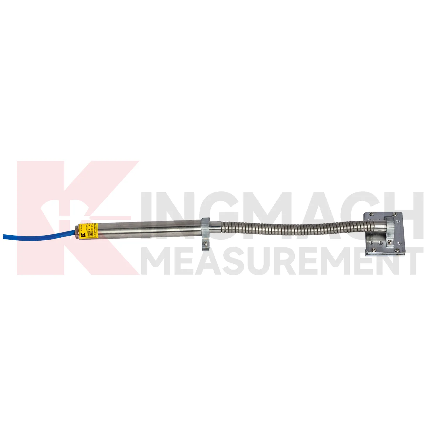
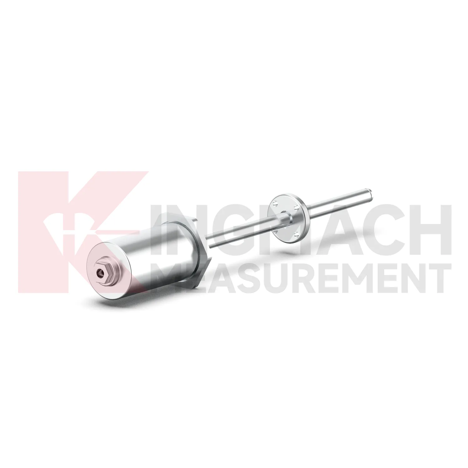
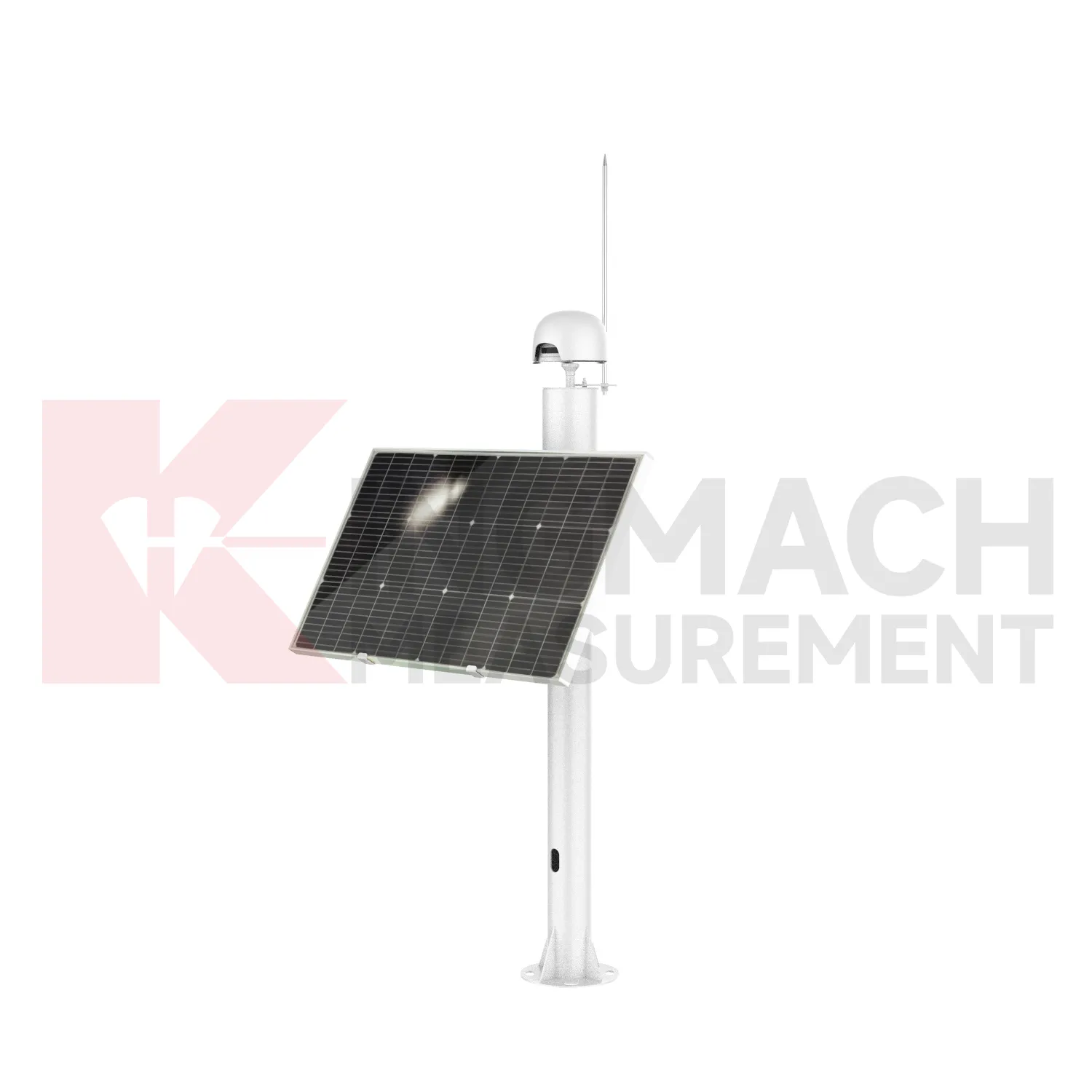
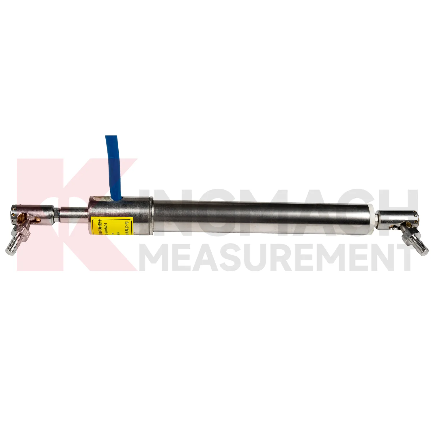
In slope and landslide monitoring, Integrated GNSS are used to detect surface creep, deep sliding, retaining wall movement, crack expansion, and displacement between fixed reference points. The challenge is that slope movement may be slow for weeks and then accelerate after rainfall, excavation, blasting, or traffic vibration. Kingmach JMDL-31XXAT multipoint meters can anchor several depths and separate shallow movement from deeper rock layer displacement. JMDL-32XXAT bedrock meters provide single-point embedded measurement with 50 mm, 100 mm, and 200 mm ranges, 0.01 mm resolution, 0.5%FS accuracy, and -30 degrees Celsius to +80 degrees Celsius operating temperature. JMLS-22XXADT wire rope sensors support 500 mm to 2000 mm movement paths with IP67 sealing. When these readings are reviewed with rainfall, pore pressure, tilt, and GNSS data, engineers can identify whether the slope is stable, creeping, or moving toward a warning threshold. During operation, the monitoring team should keep the baseline, temperature, inspection notes, and nearby sensor behavior in the same review file. This makes it easier to tell whether a movement trend comes from normal service, a repair event, changing load, water influence, or developing structural risk. Clear records also help owners decide when a field inspection is needed instead of waiting for visible damage.
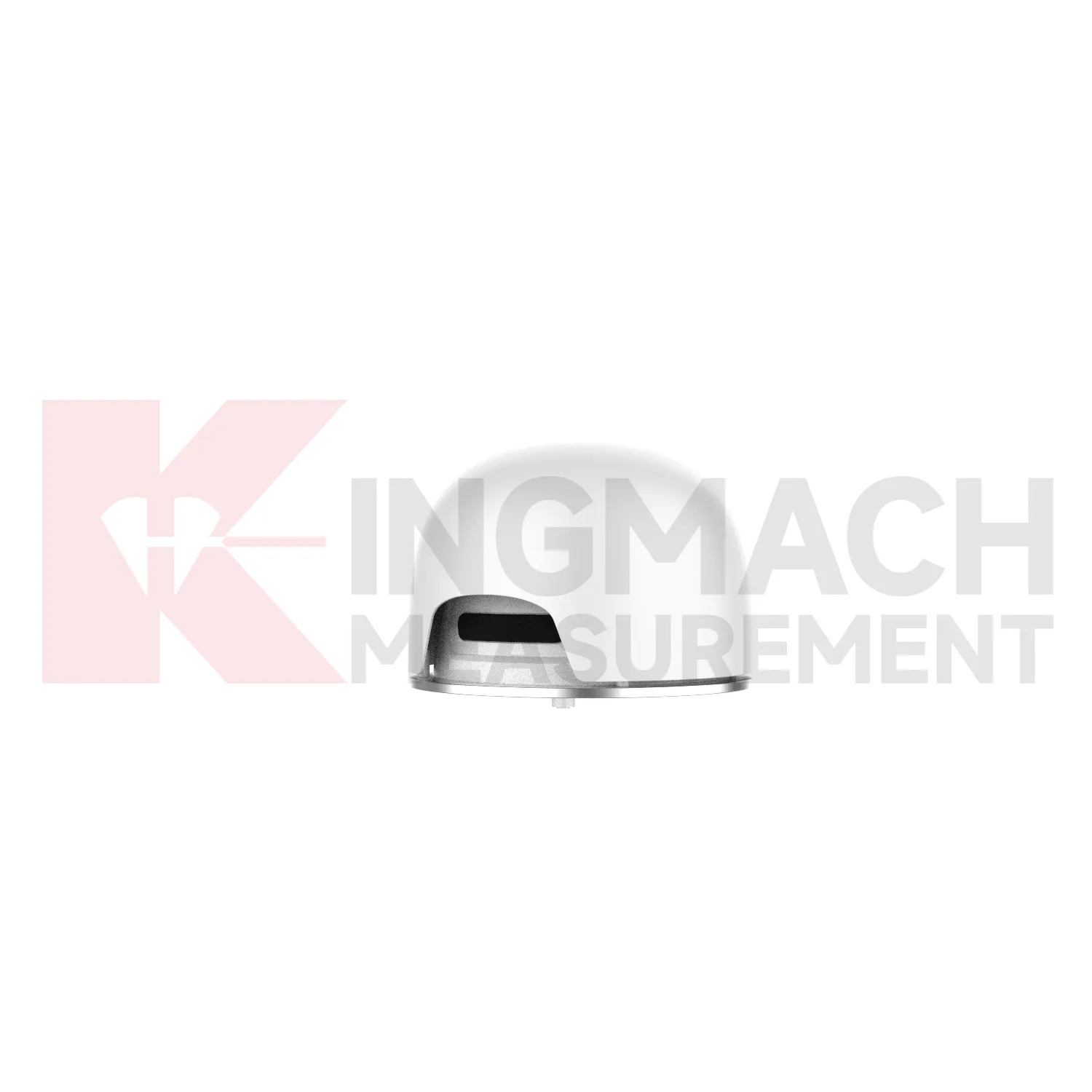
The future of Integrated GNSS
The future of Integrated GNSS will be shaped by connected monitoring rather than isolated field readings. Kingmach products already include digital detection, RS485 communication on selected models, built-in memory, stored calibration data, and compatibility with automatic acquisition systems. The next practical step is cleaner connection between the sensor identity, the monitoring point, and the platform curve. A displacement value should arrive with its model, serial number, range, calibration coefficient, zero value, temperature, and installation position. That will reduce channel errors and make later review faster. In bridges, tunnels, dams, slopes, and foundation pits, future systems will compare displacement with strain, load, tilt, settlement, rainfall, water level, and construction events. Warnings will depend less on a single limit and more on the pattern of movement across several related sensors. The strongest systems will still depend on careful installation, because digital tools cannot correct a loose bracket, wrong range, or poorly recorded baseline. Clear reporting will make displacement monitoring more useful for non-specialist decision makers while preserving the detail engineers need.
Care & Maintenance of Integrated GNSS
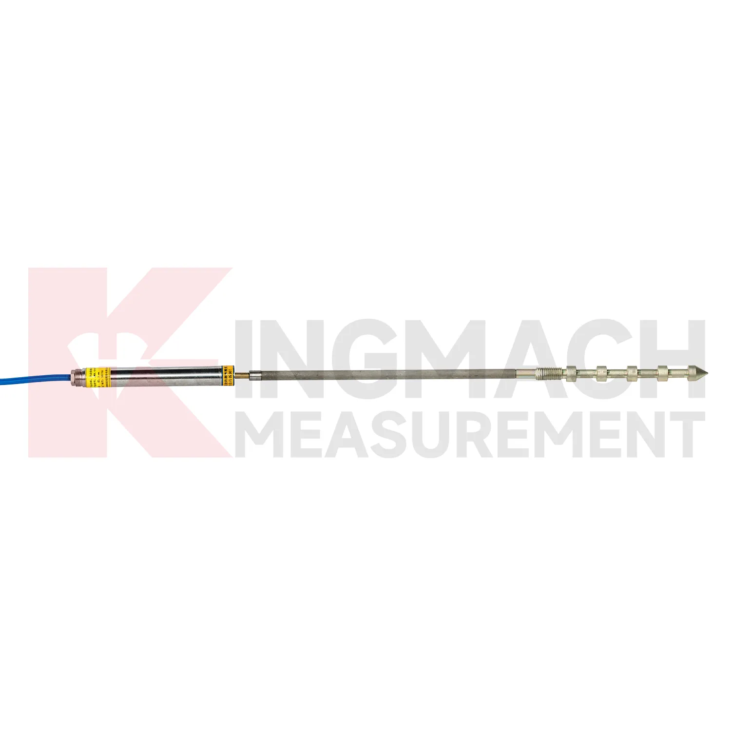
For flexible geogrid Integrated GNSS, installation care is more important than later access because the product may be buried inside reinforced soil. Kingmach JMDL-24XXAT uses a bendable measuring rod, 30 mm and 50 mm ranges, 0.01 mm sensitivity, 0.5%FS accuracy, 20-point curve fitting, and a designed service life up to 30 years. Both ends of the geogrid should be clamped with the flexible sensor sections using mounting brackets so deformation transfers reliably. Avoid sharp bending, cable tension, bracket slippage, and damage during filling or compaction. Record the geogrid layer, chainage, depth, sensor direction, zero value, and backfill date. During operation, compare displacement with settlement and rainfall records. If the trend changes after heavy rain, traffic loading, or nearby excavation, inspect accessible cabinets and cables before deciding whether the buried geogrid movement itself has changed. Keep the installation photo, point number, zero value, and expected movement direction with the commissioning record for later review. If a reading changes after maintenance work, inspect the base, anchor, cable, and cabinet before assuming the structure itself has moved.
Kingmach Integrated GNSS
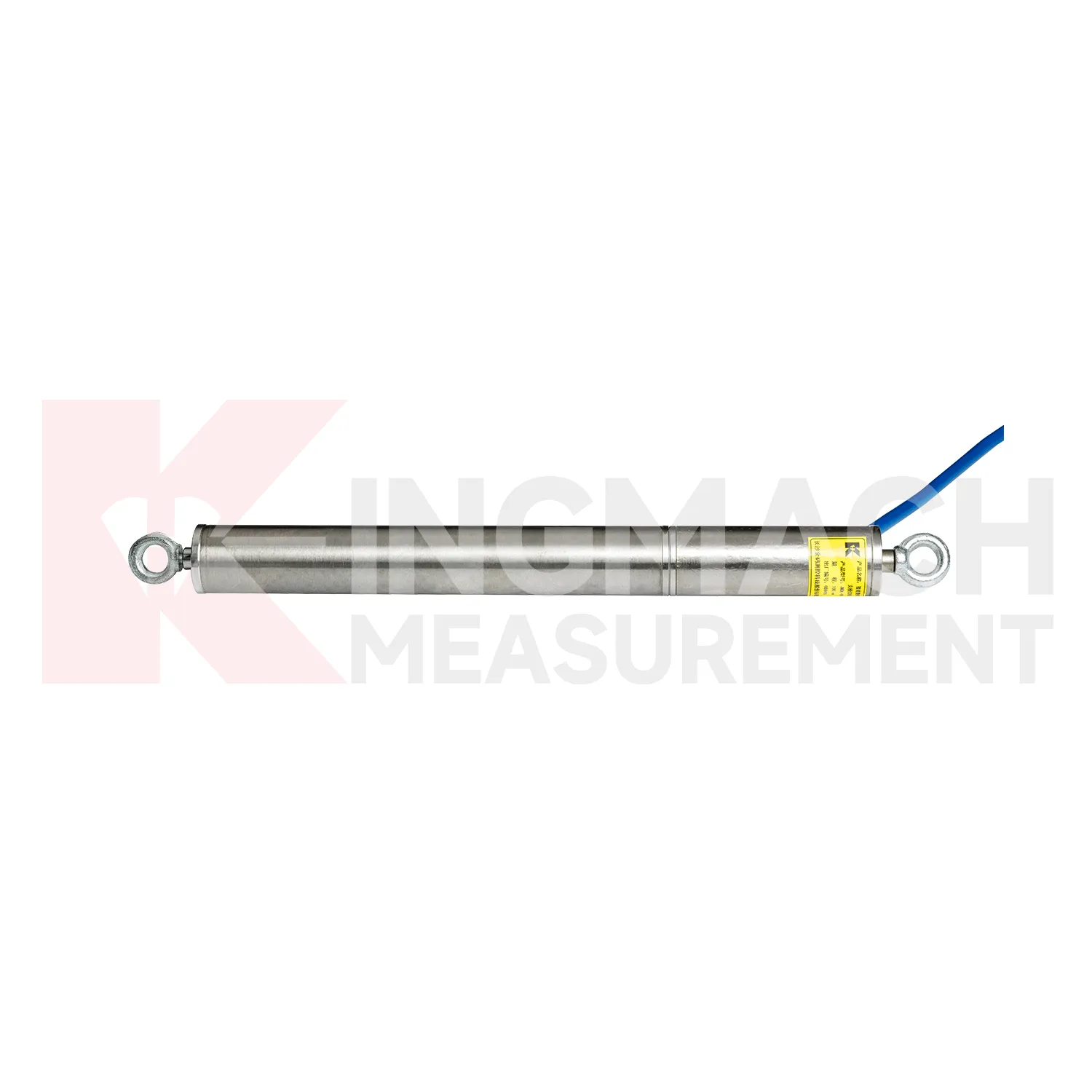
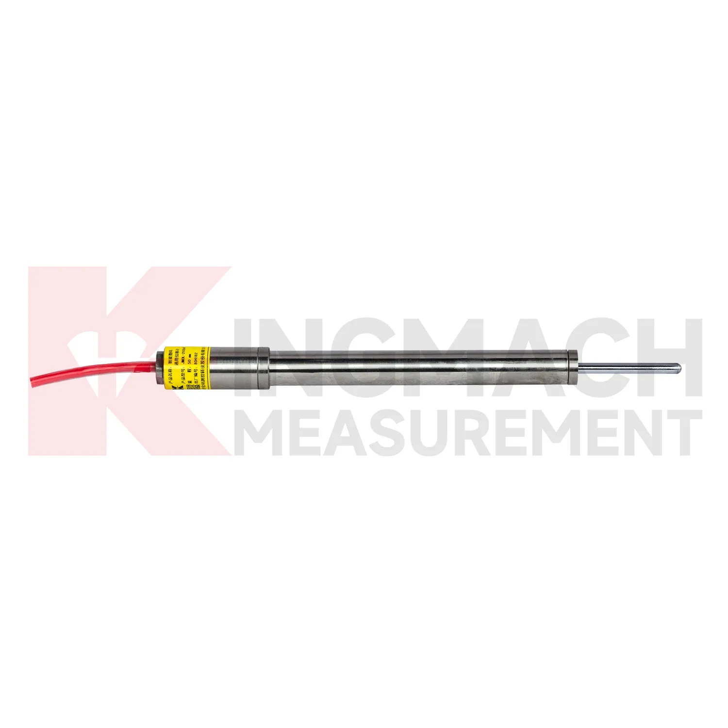
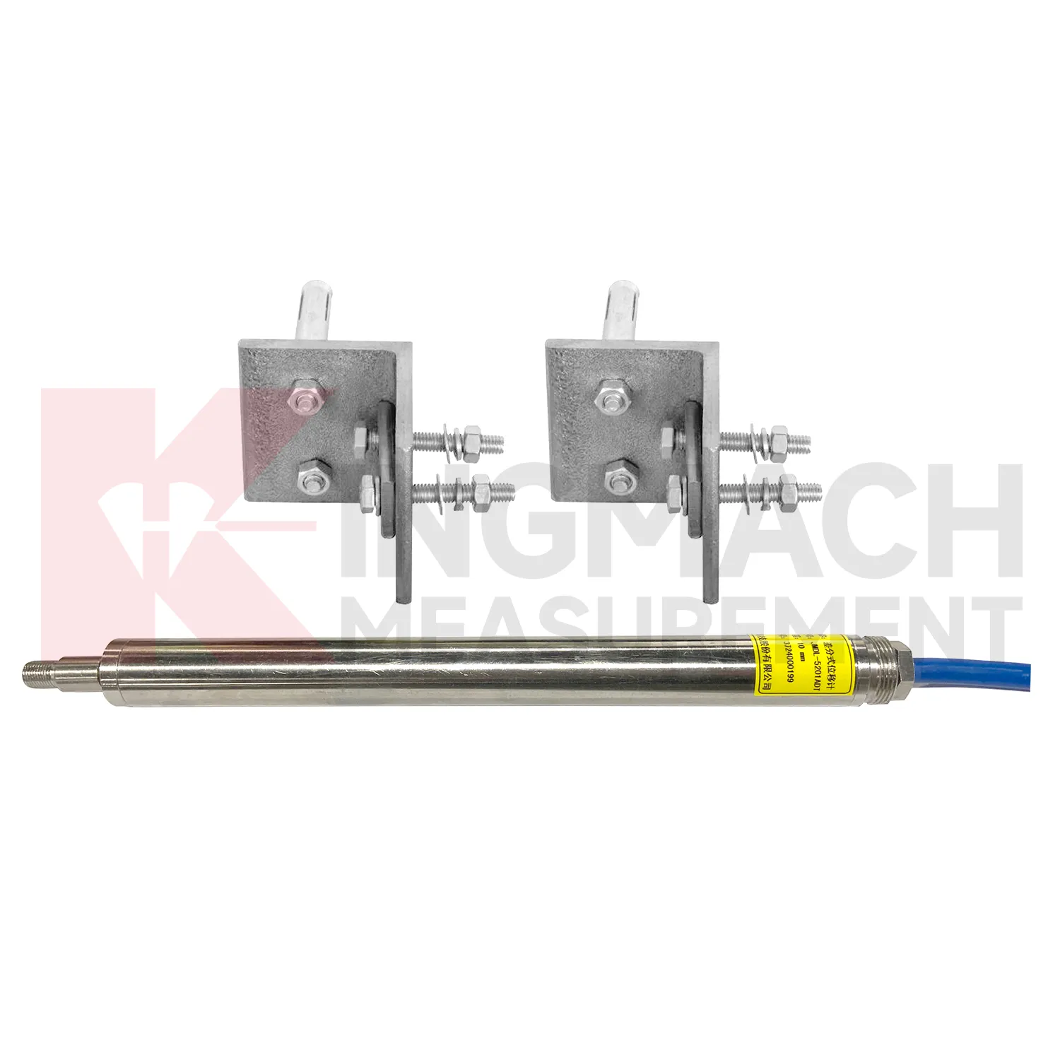
Integrated GNSS are often the quiet part of a monitoring system, but they decide whether deformation is understood as a trend or discovered as damage. Kingmach displacement products can be placed at expansion joints, cracks, foundation pits, slope faces, tunnel surrounding rock, dam bedrock, railway subgrades, high-formwork supports, and equipment stroke positions. Many models support digital transmission, anti-interference performance, waterproof sealing, and connection to automatic acquisition systems. The JMDL-21XXAT general-purpose meter records relative displacement and expansion joint movement with 50 mm or 100 mm ranges and 0.01 mm resolution. The JMDL-31XXAT multipoint meter can be installed by drilling and grouting, with anchor heads at different depths. When readings are reviewed with settlement, tilt, rainfall, pore pressure, or construction logs, engineers can see whether movement is seasonal, load-related, excavation-driven, or moving toward a control limit. The point should be named on the drawing, linked with its cable route, and checked against the expected movement direction before the first automatic reading is accepted. For daily review, the reading should be compared with nearby points, recent weather, site operations, and any loading event that could explain the movement.
FAQ
Q: Which Integrated GNSS handle long travel?
A: JMLS-22XXADT wire rope sensors cover 0 to 500 mm, 0 to 1000 mm, and 0 to 2000 mm ranges, while JMCW-21XXADT magnetostrictive meters cover 0 to 1000 mm absolute position measurement.
Q: What is the difference between wire rope and magnetostrictive types?
A: Wire rope sensors convert cable extension or retraction into displacement data, while magnetostrictive meters use non-contact sensing for absolute linear position.
Q: What protection ratings are listed?
A: Product information lists IP67 for the JMLS-22XXADT wire rope sensor and IP67 for the JMCW-21XXADT magnetostrictive meter.
Q: What communication is available?
A: Both products list RS485 communication, which supports digital connection to acquisition systems.
Q: Where are long-travel models used?
A: They are used in dam monitoring, geohazard prevention, machinery position, hydraulic cylinders, gate movement, tunnel clearances, and structural displacement between two points.
Reviews
James Thompson
The tiltmeters and accelerometers are very sensitive and provide precise data. Perfect for our structural health monitoring system.
Joshua Clark
We ordered a full monitoring solution including sensors and data loggers. Everything works seamlessly together. Great supplier!
Latest Inquiries
To protect the privacy of our buyers, only public service email domains like Gmail, Yahoo, and MSN will be displayed. Additionally, only a limited portion of the inquiry content will be shown.
Harper***@gmail.comIndia
Dear Sir, we are planning to procure a complete monitoring system including strain gauges, tiltmeter...
Ava***@gmail.comAustralia
Hi, I am looking for reliable tiltmeters and accelerometers for structural health monitoring. Please...
Related product categories
- displacement sensor
- laser displacement sensor
- displacement sensors
- linear displacement sensor
- optical displacement sensor
- wireless displacement sensor
- laser displacement sensors
- non contact displacement sensor
- cable displacement sensor
- draw wire displacement sensor
- inductive displacement sensor
- lvdt displacement sensor