 ar
ar bg
bg hr
hr cs
cs da
da nl
nl fi
fi fr
fr de
de el
el hi
hi it
it ko
ko no
no pl
pl pt
pt ro
ro ru
ru es
es sv
sv tl
tl iw
iw id
id lv
lv lt
lt sr
sr sk
sk sl
sl uk
uk vi
vi et
et hu
hu th
th tr
tr fa
fa ms
ms hy
hy ka
ka ur
ur bn
bn mn
mn ta
ta kk
kk uz
uz ku
ku
GNSS
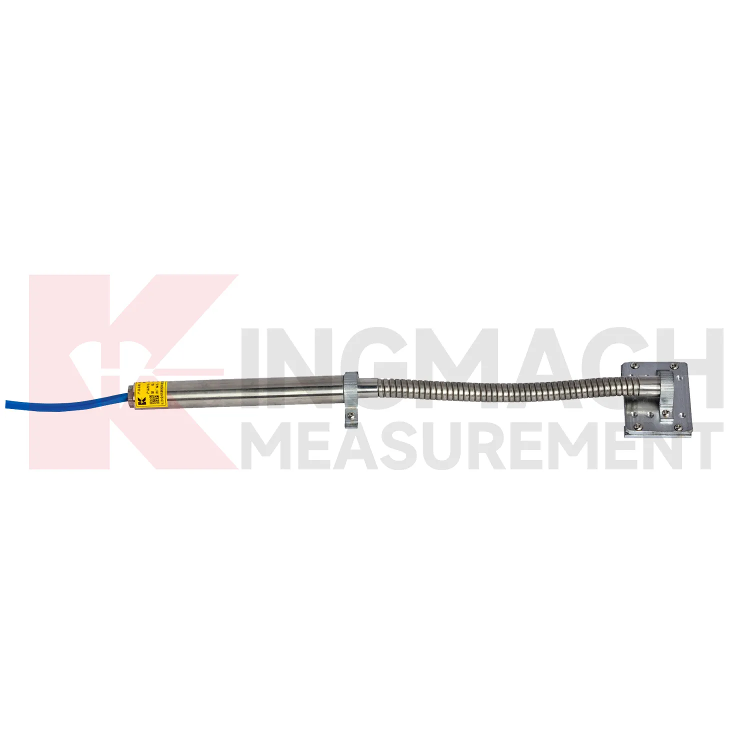
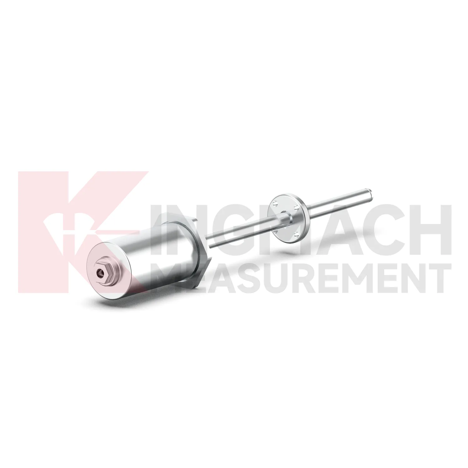
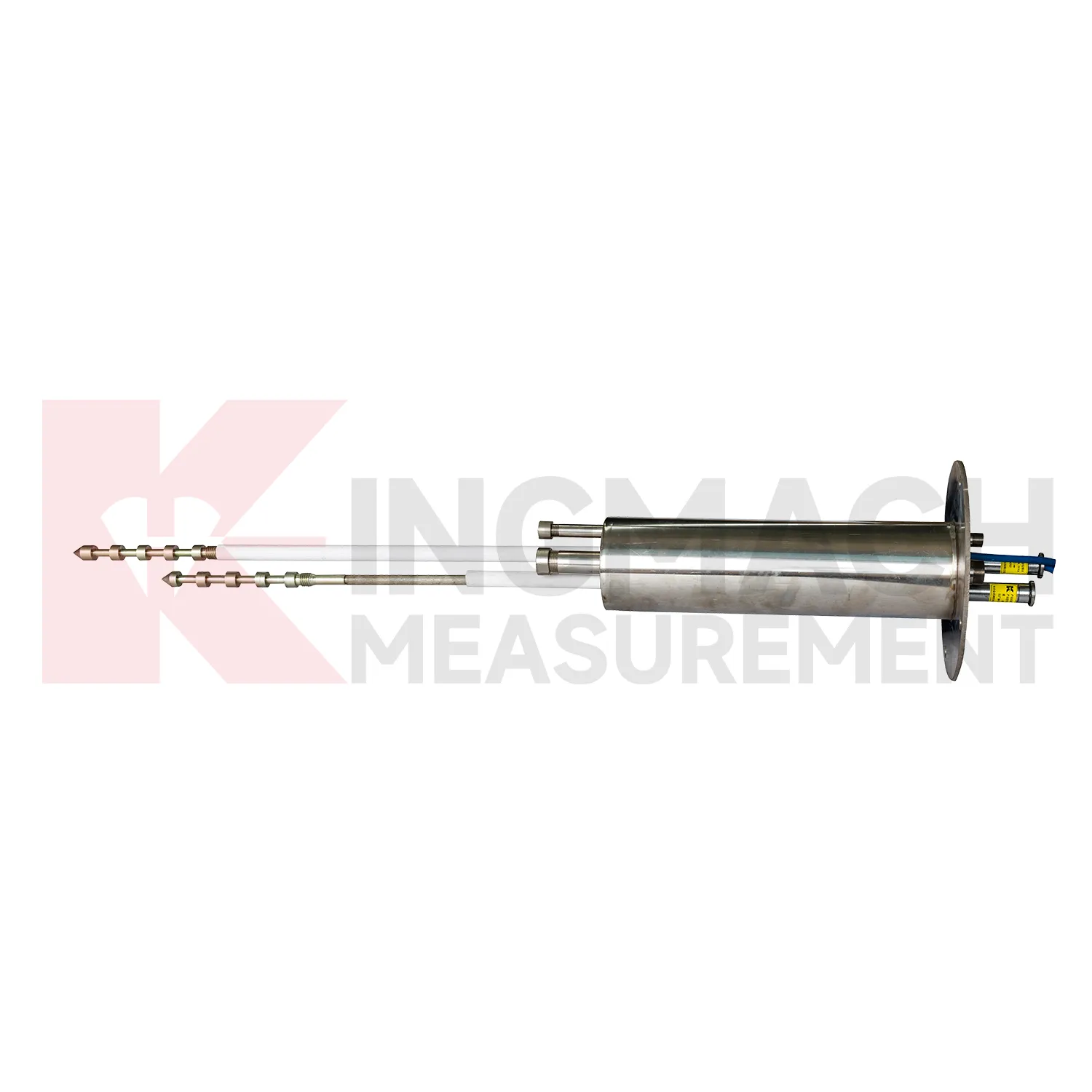
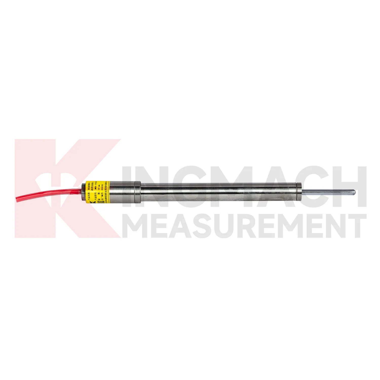
Kingmach GNSS include the JMDL-31XXAT Smart Multipoint Displacement Meter for tunnels, rock slopes, foundation pits, and surrounding rock layers. This product is not used like a surface joint gauge. It is built for boreholes where movement must be separated by depth. The instrument group includes displacement gauges, PVC measuring rod protective tubes, anchor heads, and multipoint installation kits that support three to five points. During installation, the borehole is prepared, anchor heads are set at selected layers, and grouting fixes each anchor to its target rock or soil zone. Listed models include 50 mm, 100 mm, and 200 mm ranges, all with 0.01 mm resolution. The sensing circuit changes output frequency as the measuring rod moves through the coil, so each channel can report how one anchored layer moves relative to the reference head. This layout is useful when tunnel crown movement, slope slip, or foundation pit deformation may start at one depth before it appears elsewhere. Field records should emphasize borehole number, anchor depth, grout condition, channel order, and the direction of expected movement. During later review, engineers can compare shallow and deep anchors to judge whether the deformation is local relaxation, progressive sliding, or full-section movement. That layered view is the main reason to use a multipoint instrument instead of several unrelated surface gauges.
Application of GNSS
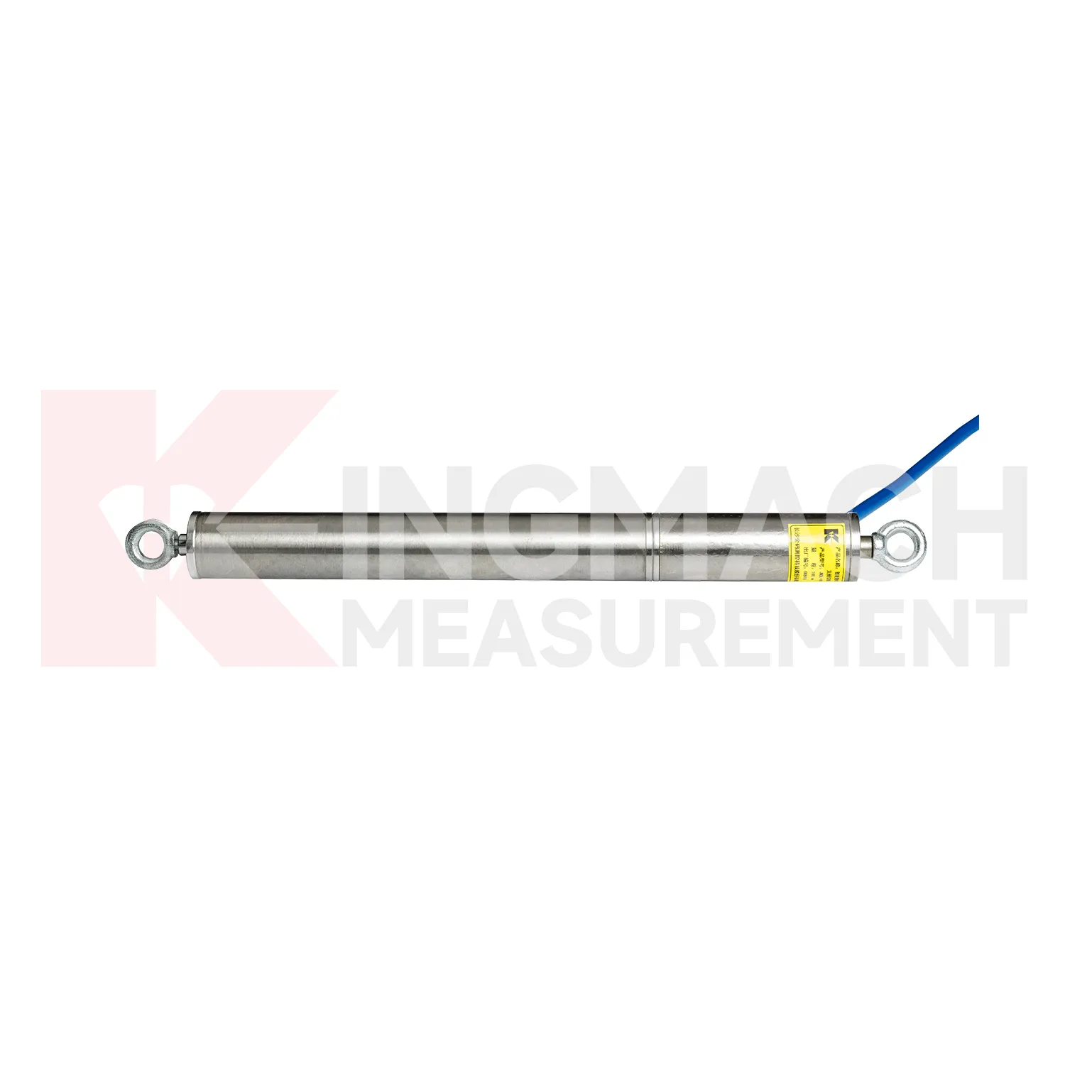
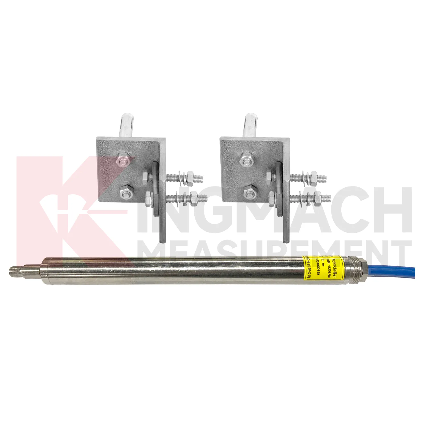
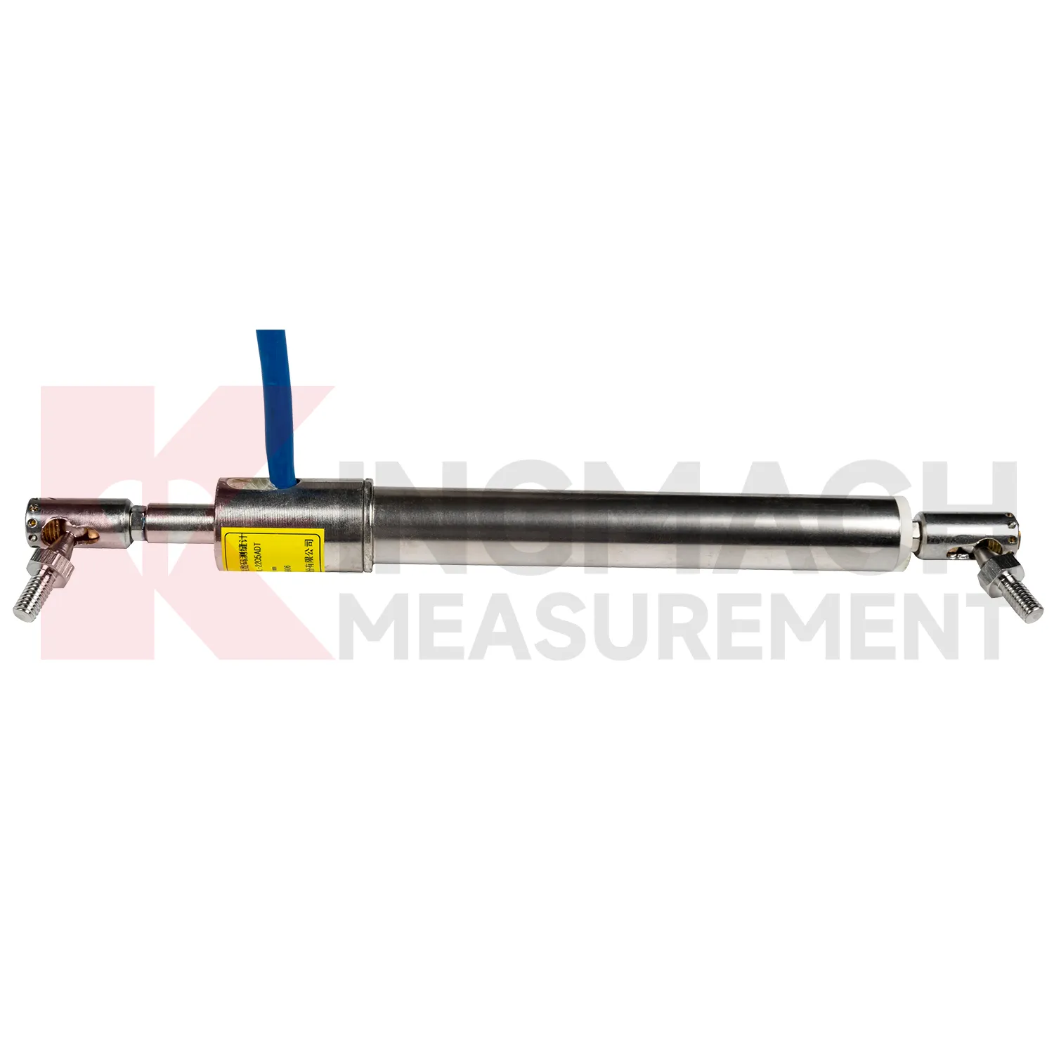
In foundation pit and deep excavation projects, GNSS are used to watch retaining walls, soldier piles, soil nails, nearby pavements, basement walls, and adjacent structures as excavation stages remove support from the ground. The main site concern is not only how far one point moves, but whether movement grows after each excavation layer, support installation, dewatering step, or backfill stage. Kingmach JMDL-32XXAT single-point bedrock meters can measure embedded displacement at a selected reference layer, while JMDL-22XXAT crack gauges follow opening at nearby structures or retaining elements. JMDL-52XXADT differential meters provide high-resolution relative movement at joints or structural interfaces, and JMLS-22XXADT wire rope sensors can cover longer exposed paths where access is available. A useful pit monitoring plan records excavation depth, support timing, groundwater level, construction vibration, and surrounding building observations beside each displacement curve. This helps engineers distinguish bracket disturbance from real ground movement, and it supports faster decisions when a wall, road edge, or adjacent building begins to respond to excavation. During review, the same point should be compared with nearby settlement, tilt, support force, groundwater, and inspection notes so the movement is interpreted as part of the excavation behavior rather than as a single isolated value. during maintenance.
The future of GNSS
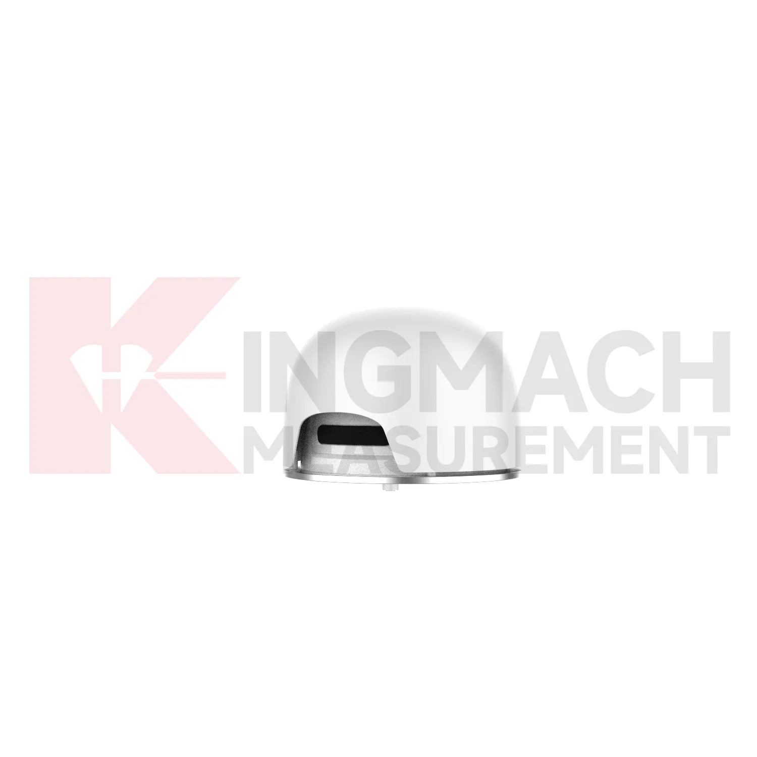
Future GNSS will also become easier to install in cramped and irregular field locations. Many monitoring points are not clean laboratory setups; they are narrow tunnel headings, wet dam galleries, crowded bridge joints, temporary formwork frames, steep slopes, and machinery spaces with limited room for tools. Smaller housings, clearer mounting accessories, stronger cable exits, and simpler alignment checks will reduce installation errors. Kingmach already uses several physical formats, including crack gauges with measuring rods and bases, draw-wire sensors for longer travel, embedded bedrock assemblies, flexible geogrid meters, and non-contact magnetostrictive meters. Future product development can make these formats more modular, so engineers select the mounting kit, cable protection, connector type, and acquisition method together. That would shorten commissioning time and make later maintenance less dependent on the original installer. For projects with many measurement points, practical installation improvements can be as important as another decimal place of resolution, because a well-mounted sensor gives cleaner data from the beginning.
Care & Maintenance of GNSS
For embedded GNSS such as multipoint and bedrock displacement meters, maintenance depends heavily on installation records because the sensing parts may not be visible after grouting or backfilling. For JMDL-31XXAT multipoint meters, keep drilling depth, anchor head depth, grouting date, point number, cable route, and baseline readings in one record. The system may monitor three to five points, so channel naming must be exact. For JMDL-32XXAT single-point bedrock meters, record flange position, tie rod condition, anchor point, PVC pipe route, and expected movement direction. During service, compare adjacent depths rather than reading each channel alone. A shallow layer moving while deeper layers remain steady has a different meaning from full-depth displacement. Do not pull or shorten cables during cabinet work, and protect exposed sections from water, rodents, sharp edges, and construction traffic. Keep the installation photo, point number, zero value, and expected movement direction with the commissioning record for later review. If a reading changes after maintenance work, inspect the base, anchor, cable, and cabinet before assuming the structure itself has moved.
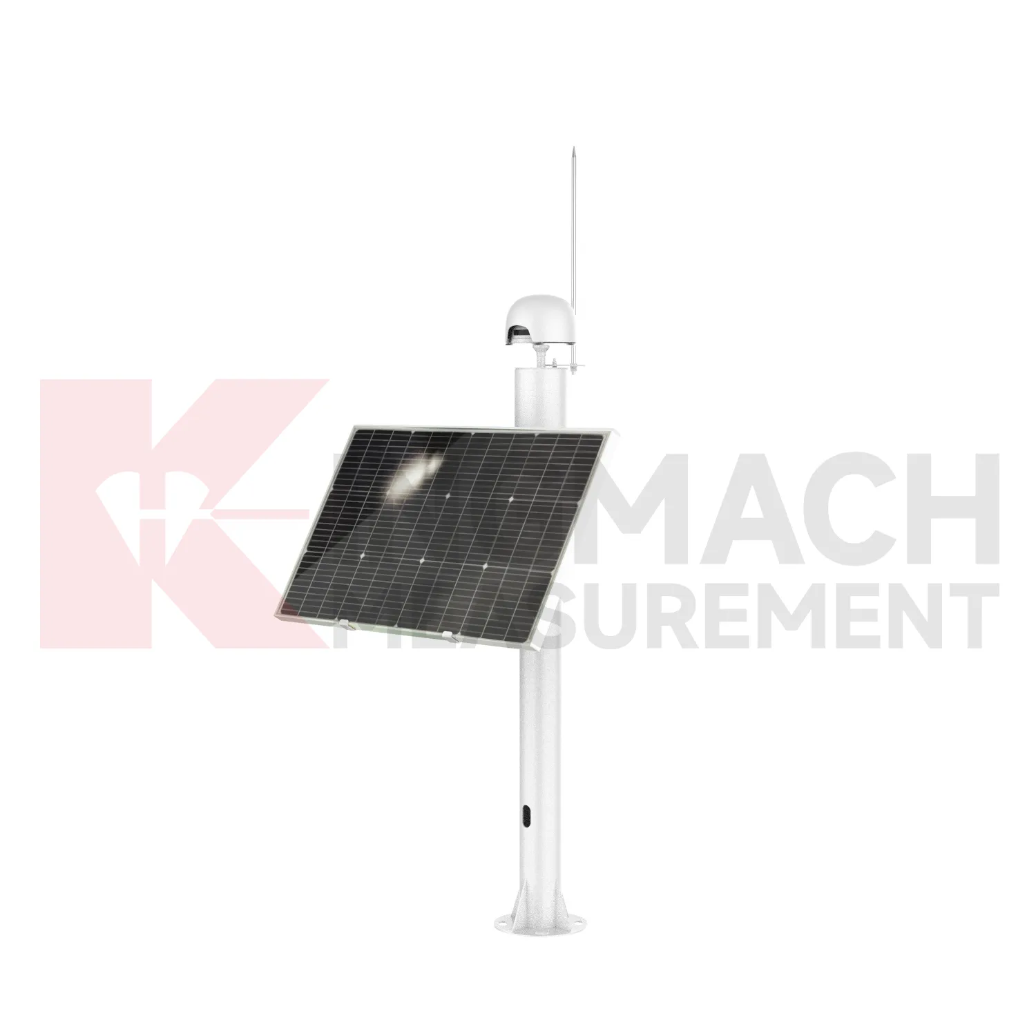
Kingmach GNSS
GNSS help engineers separate normal movement from structural risk. A bridge expansion joint may move with temperature, a tunnel lining may shift after excavation, and a slope may creep slowly before an alarm condition appears. Kingmach displacement products use several sensing routes, including inductive frequency modulation, differential coil measurement, magnetostrictive sensing, draw-wire conversion, and GNSS-based displacement tracking. Ranges can start at 20 mm for joint monitoring and extend to 2000 mm for draw-wire applications, while selected smart models store model data, serial numbers, calibration coefficients, zero values, temperature, and hundreds of measurement records. This makes the reading easier to trace during acceptance, maintenance, and later review. For a project buyer, the practical question is whether the movement point is exposed, embedded, multi-depth, long-distance, waterproof, or tied to geogrid. Kingmach provides different forms for those different site conditions. The point should be named on the drawing, linked with its cable route, and checked against the expected movement direction before the first automatic reading is accepted. For daily review, the reading should be compared with nearby points, recent weather, site operations, and any loading event that could explain the movement.
FAQ
Q: Which GNSS are used for rock layers or bedrock?
A: JMDL-31XXAT multipoint meters are used for different surrounding rock layers, while JMDL-32XXAT single-point bedrock meters are used for tunnel rock mass, dam bedrock, slope, or foundation pit movement.
Q: How many points can the multipoint meter support?
A: The multipoint installation kit supports three to five monitoring points, with anchor heads fixed at different depths by drilling and grouting.
Q: What ranges are listed for these models?
A: Both JMDL-31XXAT and JMDL-32XXAT list 50 mm, 100 mm, and 200 mm models with 0.01 mm resolution.
Q: Why monitor several depths?
A: Different layers may move differently. Separating shallow and deep movement helps engineers judge whether the problem is surface creep, deeper rock slip, or overall mass movement.
Q: What records should be kept?
A: Keep drilling depth, anchor location, grouting date, channel name, zero value, cable route, and first stable reading.
Reviews
Robert Taylor
The weir flow meter is well-built and delivers accurate measurements. Great value for water management applications.
Joshua Clark
We ordered a full monitoring solution including sensors and data loggers. Everything works seamlessly together. Great supplier!
Latest Inquiries
To protect the privacy of our buyers, only public service email domains like Gmail, Yahoo, and MSN will be displayed. Additionally, only a limited portion of the inquiry content will be shown.
Evelyn***@gmail.comSouth Africa
Hi, we are a contractor working on tunnel construction and need settlement sensors and displacement ...
Isabella***@gmail.comGermany
Hello, we are evaluating weir flow meters for a water management project. Please share accuracy deta...
Related product categories
- crack monitoring gauges
- displacement crack gauge
- displacement sensor
- laser displacement sensor
- displacement sensors
- linear displacement sensor
- optical displacement sensor
- wireless displacement sensor
- laser displacement sensors
- non contact displacement sensor
- cable displacement sensor
- draw wire displacement sensor